Update Odisha-Latest Odisha News I Breaking News Get latest news on Odisha, Govt. Jobs, OSSC, OPSC, Entertainment, Crime, Sports, and Education
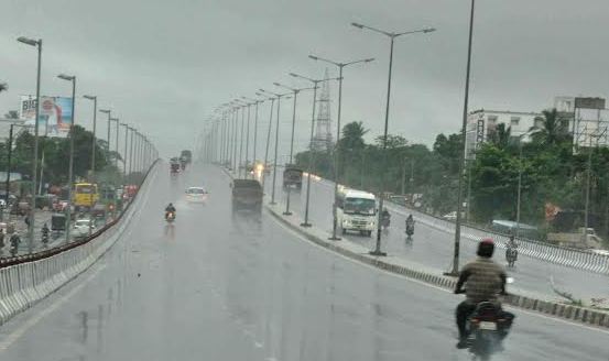
Bhubaneswar: Several parts of Odisha are likely to experience heavy rainfall in next three days under the impact of a low pressure, said met department on Saturday.
“A cyclonic circulation extending up to 7.6 km above mean sea level tilting southwestwards with height lies over northwest Bay of Bengal off West Bengal -Odisha coasts,” the Met office said in a statement.
Under its influence, a low-pressure area is very likely to develop over northwest Bay of Bengal and neighbourhood during next 24 hours.
It said rain and thundershowers are very likely to occur at many places over districts of Odisha during next 24 hours subsequent 48 hours.
The low pressure is likely to trigger heavy rainfall in the districts — Malkangiri, Koraput, Kalahandi, Kandhamal, Rayagada, Ganjam, Gajapati, Puri, Khordha, Cuttack, Jagatsinghpur — of Odisha today.
Heavy to very heavy rainfall very likely to occur over Gajapati, Ganjam, Puri, Khordha, Nayagarh, Balasore, Cuttack, Rayagada, Kalahandi, Kandhamal, Nabarangpur and Balangir districts of Odisha tomorrow.
Moreover, isolated heavy to very heavy rainfall is likely to occur over Balasore, Bhadrak, Keonjhar, Mayurbhanj, Dhenkanal, Angul, Deogarh, Sundargarh, Sambalpur, Jajpur, Jagatsinghpur, Kendrapara, Cuttack, Kalahandi, and Nuapada districts on August 20.
Meanwhile, the met office predicts thunderstorm, lightning, moderate rainfall at one or two places over Sambalpur, Jharsuguda, Sundergarh, Deogarh, Kendrapara, Jagatsinghpur, Puri, Rayagada, Ganjam, Gajapati, Kandhamal, Nayagarh, Cuttack, Puri, Khurda districts till 8 PM on Saturday.
Fishermen are advised not to venture into deep sea northwest and the west central Bay of Bengal area on August 19 and 20.