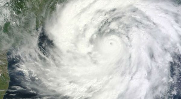
Bhubaneswar: The deep depression over East-central Bay of Bengal has intensified into cyclonic storm ‘Yaas’, informed the India Meteorological Department (IMD) on Monday.
It is likely to intensify into a Severe Cyclonic Storm during next 24 hours and into a Very Severe Cyclonic Storm during subsequent 24 hours, the IMD said.
The system is very likely to cross north Odisha-West Bengal coasts between Paradip and Sagar Island around noon of 26th May as a Very Severe Cyclonic Storm.
Light to moderate rainfall is likely at many places with heavy falls at isolated places over south Coastal Odisha on 24th May, heavy to very heavy rainfall in the north coastal districts on 25th May, heavy to very heavy rainfall at a few places with extremely heavy falls in Balasore, Bhadrak, Kendrapara, Mayurbhanj and heavy to very heavy falls at a few places in Jagatsinghpur, Cuttack, Jajpur, Keonjhar on 26th May and heavy to very heavy rainfall at isolated places in north interior Odisha on 27th May.
Isolated heavy to very heavy rainfall is likely over south coastal districts of Odisha during 25th and 26th May.
Squally wind speed reaching 40-50 kmph gusting 60 kmph is very likely to prevail over North Bay of Bengal and adjoining west central Bay of Bengal along and off north Andhra Pradesh-Odisha–West Bengal–Bangladesh coasts from 24th May afternoon.
It would increase gradually becoming 50-60 kmph gusting to 70 kmph from 25th May evening. It would further increase becoming gale wind speed 60-70 kmph gusting to 80 kmph from 26th May early hours over northwest Bay of Bengal and along and off West Bengal & north Odisha and Bangladesh coasts.
It would gradually increase further becoming 90-100 gusting to 110 kmph from 26th morning and increase thereafter becoming 155-165 kmph gusting to 180 kmph at the time of landfall.
 Update Odisha-Latest Odisha News I Breaking News Get latest news on Odisha, Govt. Jobs, OSSC, OPSC, Entertainment, Crime, Sports, and Education


