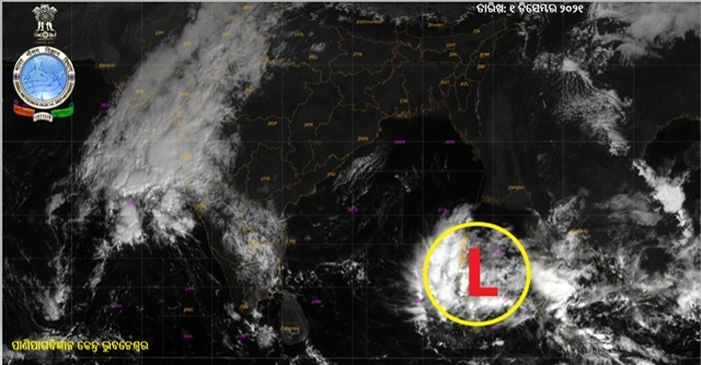
Yesterday’s low pressure over south Thailand and neighbourhood emerged into central Andaman Sea in the same evening. It is likely to move west-northwestwards and concentrate into a depression over southeast and adjoining east-central Bay of Bengal by tomorrow and intensify into a cyclonic storm over central parts of the Bay of Bengal during the subsequent 24 hours. This was informed by India Meteorological Department today.
Subsequently, it is likely to move northwestwards, intensify further and reach near north Andhra Pradesh – Odisha coasts on December 4morning.
Light to moderate rain or thundershower is very likely to occur at many places over the districts of south coastal Odisha and at a few places over rest districts Odisha on December 3, light to moderate rain or thundershower is very likely to occur at most places over districts of coastal Odisha and at many places over the districts of interior Odisha on December 4 and light to moderate rain or thundershower is very likely to occur at most places over the districts of north coastal Odisha and at many places over rest districts of Odisha on December 5.
Fishermen have been advised not to venture into southeast and adjoining east-central Bay of Bengal on December 2 and 3, west-central & adjoining northwest Bay of Bengal and along & off north Andhra Pradesh-Odisha-West Bengal coasts during December 30 to 5.