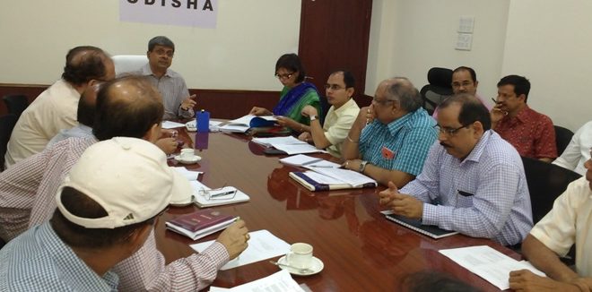
Bhubaneswar: A Governing Body meeting of Odisha Land Records Modernization Society (OLRMS) was held to discuss on how Odisha become a leading performer in the modernisation of land records.
Reviewing the progress made so far, Chief Secretary Aditya Prasad Padhi on Tuesday advised the department to work out a strategic DPR for undertaking a hi-tech survey of the land records in the entire State.
Presently hi-tech survey is being piloted in 9 districts. He advised preparing the strategic DPR with the learning and feedback availed from the pilot.
The digital data collected from the hi-tech survey would be stored in the data center with 24×7 security measures. A sub-committee was formed under the chairmanship of IT secretary P.K. Jena with the members from NIC, Directorate of Land Records, and ORSAC, OCAC to look into the detail of the storage, security, and usability of the data.
Chief Secretary directed to put in place appropriate interfaces for use of the data by various government departments.
Available data show that as a result of the initiatives of OLRMS, Record of Rights ( RoR) of all 51,675 revenue villages have been computerized and put online in Bhulekh website. The maps of 51,612 villages have been also digitized and uploaded to the website.
Modern record rooms have been developed in 279 tahasils out of a total 317 tahasils. Steps have been expedited for developing modern record rooms in rest of the Tahasils.
Director Land Records & Survey Upendra Nath Mallik said that the work of other 10 more tahasils are nearing completion and the modern record room would be developed soon in these 10 places.
All the 185 registration offices have been computerized. All registered deeds from 1995 onwards have been digitized and stored in the central server which is available to registration officers online for verification of the incumbency and other matters. OSWAN connectivity has been provided to 300 tahasils and 185 registration offices out of total 317 tahasils and 185 registration offices.
Transaction based online mutation software has been developed having a real time mutation of the land records. This software has been put on a pilot in 5 tahasils namely Jatani, Khordha, Nayagarh, Chhatrapaur and Jharsuguda. Presently, the resurvey work of the land records through modern technologies have been taken up in 9 districts namely Cuttack, Khordha, Ganjam, Keonjhar, Deogarh, Sundargarh, Bolangir, Subarnapur and Sambalpur.
 Update Odisha-Latest Odisha News I Breaking News Get latest news on Odisha, Govt. Jobs, OSSC, OPSC, Entertainment, Crime, Sports, and Education


